

Kartoffelbrei dickt kalt ein - oder bleibt das eine flüssige Plörre?
Beiträge von caficon
-
-
So rechne ich:
Alles, was Kalorien aus Kohlehydraten zieht, hat über den Daumen 350. Fett hat (rein, aber das gibt es kaum) um die 900, ich rechne es mit 700. Eiweiß so 400. Das reicht mir - meist mach ich nicht mal das. Denn:IMHO wird das für Normalwanderungen bis - sagen wir - drei Wochen komplett überschätzt. Jedenfalls für mich. Die meisten von uns - auch ich - haben genügend im internal food storage system, um ggf. Kaloriendefizite locker zu kompensieren. Wichtig ist, satt schlafen zu gehen und tagsüber nicht zu unterzuckern, weil das auf die Laune schlägt. Und essen einfach Spaß macht - jedenfalls wenn es schmeckt.
-
Meine Beobachtung: Man muss nicht die gesamte benötigte Flüssigkeitsmenge von Anfang an dazugeben. Das initiale Quellen dauert am längsten. Das kann sinnvoll sein, wenn man sich z.B. nicht hundertprozentig sicher ist, dass der verwendete Behälter (noch) wasserdicht ist (Salbenkruke, Toppits in der zehnten Verwendung) bzw. der Deckel sich wirklich nicht ablöst (GSI-Tassen). Die restliche Flüssigkeit zieht relativ schnell ein.
Zumindest bei den Nahrungsmitteln, die ich nur kalt in meiner Salbenkruke ansetze, klappt das: Haferflocken / Müsli / Trockenobst, Couscous, Kuko-Reis.
Mit welchen Gemüsen / (gefrier)getrockneten Hülsenfrüchten funktioniert das ebenfalls?
-
Den Zwei-in-eins Instant-Kaffee (den noch süßeren 3-in eins bestimmt auch) kann man prima in kaltem Wasser auflösen - in der Flasche durchschütteln, bis er richtig schaumig ist. Wenn das Wasser richtig kalt ist, hat man (bei ein wenig Gewöhnung) eine recht gelungene Illusion von Frappé.
-
Auf der Packung vom Wurzener Kuko-Reis steht (anders als in der Online-Beschreibung) drauf, dass er auch ohne Kochen - einfach mit kaltem Wasser - weich werde.
Das könnte dann wie coldgesoaktes Couscous weiterverwendet werden.
Bei mir in Berlin bekomme ich das bei REWE, aber auch einige Läden von dem EDEKA-Verbund führen es. Ob es das im Westen auch gibt, weiß ich nicht - ist ein altes Ost-Produkt. Man kann es aber online ordern.
Ob Wurzener Pilzreis und Gemüsereis ebenfalls kalt zubereitet werden kann, weiß ich nicht, aber vielleicht hat ja jemand Lust, das auszuprobieren.
-
Lasst es mal gut sein. Wir kümmern uns…
-
Vielleicht möchte Olav sich jetzt erst einmal mit all dem guten, informativen Input, den er bekommen hat, den Informationen in unserem Wiki und auf den Seiten von renommierten und bekannten Händlern gefunden hat , beschäftigen.
Sollten dann immer noch Fragen offen bleiben, kannst du dich gerne wieder melden. -

Eigentlich wie die Strickjacke von Oma seinerzeit, nur leichter, aber auch weniger langlebig.
solang die Motten die Jacke noch nicht gefunden hatten
-
Ja, ich finde die Merrell Vapor Gloves auch super bequem im Alltag, aber halt etwas schmal (als Mann mit dem Männermodell). Weißt Du zufällig, ob Trail und Vapor Gloves die gleiche Breite haben? Und bringt eine Größe höher nennenswert was für die Breite vorne?
Zu den Vapor Gloves kann ich nicht viel sagen. Vor einigen Jahren hatte Globetrotter gelegentlich beides im Programm, da habe ich probiert:
Trail Glove 40 Frauen: viel zu schmal
Trail Glove 40 Männer: mein Standardmodell
Vapor Glove 40 Männer: für meine Füße, meinen Geschmack damals zu flexibel, aber ich erinnere kein "weiteres" "breiteres" Gefühl am Vorderfuß.Gerade noch geguckt, ich habe vom Trail Glove 7 noch eine 41 rumliegen (Fehlkauf, vergessen zurückzuschicken): Der ist nicht breiter als der 40er.
Inwieweit das auf den Vapor Glove übertragbar ist - und auf andere Größen, ab irgendwo muss der da ja mal breiter werden - keine Ahnung.
Hast du es mal mit dem Kundenservice von Bergfreunde versucht? Die wissen manchmal was... -
-
Dieser Thread ist für Fragen gedacht, die noch nicht im Wiki beschrieben sind.
Meine Frage bezieht sich auf physikalische Eigenschaften von Gas in der Kartusche, das ja nicht gasförmig, sondern zu großen Teilen flüssig ist.
Folgendes Szenario: Ich befülle aus einer vollen großen Kartusche (450 oder 230) eine kleine leere Kartusche.
Der Druck is da schon so unterschiedlich, dass ich nicht die kleine kühlen und die volle große erwärmen muss.
Wenn ich nun den Adapter draufgeschraubt habe, die volle Kartusche oben, die kleine leere unten habe - kann da mehr Gas von oben nach unten in die kleine fließen als hineindarf, oder hört das Fließen auf, sobald ein Druckausgleich hergestellt ist?Nach meinem superlaienhaften bildlich-anschaulichen Verständnis: Verhält sich sich das Flüssiggas dabei wie eine Flüssigkeit (wie Wasser) und füllt das ganze zur Verfügung stehende Volumen der kleinen Kartusche aus - was dann natürlich zu viel wäre, oder verhält es sich wie Gas, sodass doch eigentlich bei Druckausgleich Schluss sein müsste, ich also vermutlich (wenn ich nicht durch Temperaturunterschiede nachhelfe) gar nicht überfüllen könnte?
-
Hier scheint es am besten hinzupassen:
Habe mir mal wieder neue Merrell trail gloves gegönnt. Es ist jetzt der Trail Glove 8.Ich nehme immer das Männermodell in der kleinsten Größe - das Frauenmodell ist mir erfahrungsgemäß viel zu schmal (das sind seit dem Trail Glove 3 oder 4 meine Normalschuhe fürs normale Stadtleben bis hin zu typischen Tageswanderungen bis 20km).
Beim 7er (ich weiß nicht mehr, ob beim 6er auch schon) war die zeitweilig übertriebene "Unterstützung" des Fußgewölbes wieder zurückgenommen worden, das wurde (für mich zum Glück) beibehalten.Veränderungen gegenüber dem 7er:
andere Sohle - weiß nicht, was das soll, aber wirkt nicht steifer als beim 7er (habe noch ein neues andersfarbiges Exemplar davon zum Vergleichen)
die Zunge ist beim 8er auf der Innenseite bis obenhin fest mit dem Schuh verbunden. Für mich, die ich grundsätzlich die beiden obersten Löcher beim Schnüren freilasse, weil mich die Zunge sonst am Übergang Rist-Bein nervt, ist das störend... von diesem Modell kaufe ich mir keine weiteren Farben mehr... -

Andererseits würden Piercings nicht mal beim skin out weight dazugehören.... Schauder.

nur zum Teil

-
Auch ich war über Pfingsten wieder unterwegs. Nach der Wanderung, die noodles vor drei Wochen im Harz organisiert hatte, wollte ich den Selketalstieg in voller Länge wandern - das haben wir nicht getan. Sondern haben eine Rundtour vom Bahnhof Thale draus gemacht: Von Thale auf selbst zusammengesuchten Wegen und Pfaden nach Gernrode, dort auf den Selketalstieg (wir haben also das Stück ab Quedlinburg nicht gemacht.) Dann den ganzen Selketalstieg bis Güntersberge (ab da wäre es mehr oder weniger nur noch 8km lang parallel zu einer größeren Straße nach Stiege gegangen, und, Pfingsten und Schönwetter, da sind uns dort zu viele Zweiradfahrer vom Stamme "Ich lärme also bin ich" unterwegs. Stattdessen ab dort den Bode-Selke-Stieg ins Limbachtal und an der Luppbode nach Tresseburg, dann das schicke Bodetal runter zurück nach Thale. Knapp 90km.
Total schöne Landschaften. Tolles Wetter. Kröten, Blindschleichen, kleines Ringelnatterchen, paar Zecken, aber rechtzeitig gefunden, auch Dank des Partners (zum Thema "Wanderpartner"). Dieser Wanderpartner hat letztendlich auch verhindert, dass ich mir einen Fahnenappell und die dazugehörige Ansprache noch genauer angehört habe. Zunächst war ich, von Gesang angelockt, von einem Open-Air-Pfingstsonntagsgottesdienst ausgegangen. So, wie ich es auf anderen Pfingstwanderungen schon erlebt habe. Aber was bin ich für ein Dummerchen! Was ich von der Ansprache verstanden habe, der Herr sprach laut und prägnant, hat mich eines anderen belehrt. Kohten, Männer in Shorts, Frauen in weißen Blusen und wadenlangen Röcken, volksliedartiger Gesang zur Klampfe (deutsch, sauber und textsicher, habe aber trotzdem nicht viel verstanden, da die Selke rauschte - ich kannte die Lieder aber nicht, obwohl ich eigentlich noch viele Volks,- Kirchen- und Fahrtenlieder kenne). War ein Pfadfinderzeltplatz im Selketal. Waren aber auch nicht Pfadfinder. Danach Sachsen-Anhalt noch von einigen einschlägigen Aufklebern befreit.
-
Falls eine Schulter, bzw. Lymphsystem auf einer Armseite der Grund sein sollten: Vielleicht so ein Ein-Schulter-Rucksack:
ThemaWoman's Back - ein Rucksack nach Brustkrebs
[…]
Hier ist einer für Menschen, denen eine Brust und einige Lymphknoten entfernt worden sind. (Auch Männer können übrigens Brustkrebs bekommen).
Der Rucksack selber ist nicht ultraleicht , und fasst auch nur 25l, aber so umgearbeitet, dass es nicht so leicht Armlymphödeme gibt. Das reicht ja manchen für eine UL -Overnighter-Ausrüstung.
Es werden dort keine ganzen Rucksäcke hergestellt, sondern zu Einschulterrucksäcken mit speziellen Hüftgurten umgearbeitet.
Ich hatte vor einigen Jahren davon… caficon
9. Mai 2025 um 18:09 -
im Kulturbeutel-Faden hat Lina Wiese was von einer halben Beißschienenschale geschrieben
-
hoffentlich krachend scheitern
Ich weiß nicht so recht... warum? Entweder es wird erfolgreich (egal ob wegen oder trotz der Qualität), dann kanalisiert es die Wanderströme (und man hat abseits davon Ruhe), oder es "scheitert", obwohl gut, dann hat man bestenfalls eine bessere Infrastruktur, oder es scheitert, weil nicht gut, dann "so what".
Dass ich denen keinen monetären Erfolg gönne, weil ... TAZ und Kleinstanbieter wegen Pfotenmotiv verklagen, bloß weil die vorher nicht so clever waren, sich die Pfote marketingtechnisch zu sichern, steht auf einem anderen Blatt. Ich erschrecke vor mir selber: bin ich nachtragend!

-
Ich freue mich ja jedes Jahr über PCT Wanderer die mich viea You Tube Videos mit nehmen:
Hier mal mein diesjähriger Lieblings Kanal: https://www.youtube.com/@guidokochbuweiler/videos
Mir geht es ähnlich. Ich bin dieses Jahr aber bei Salawander gelandet:
SalawanderMein Leben beginnt draußen. Ob auf dem Fahrrad, zu Fuß mit Rucksack oder im Kajak – ich nehme dich mit auf meine Touren durch die Natur. Meist mehrtägig, meist…www.youtube.com -
so wie du, janphilip , mache ich es mit meinen ewigen Selbstaufblasenden auch.
-

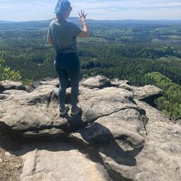
Der "große Anton" wird immer mehr zu meinem Lieblings-Shelter!
Hier auf dem Inseltreffen.wir standen bewundernd davor... very comfy...